-
ChicagoImpart Encyclopedia of Art. "Harappa." August 31, 2026. https://imp-art.org/articles/harappa/.
-
MLA"Harappa." Impart Encyclopedia of Art, Aug. 31, 2026, https://imp-art.org/articles/harappa/.
-
HarvardImpart Encyclopedia of Art (2026) Harappa. Available at: https://imp-art.org/articles/harappa/ (Accessed: 16 October 2026).
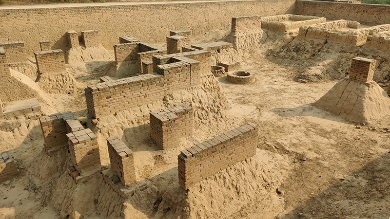
An archaeological site in the Punjab province of Pakistan, Harappa hosts evidence of one of the largest cities of the Indus Valley Civilisation, which flourished between roughly 2600 and 1900 BCE. Its sophisticated urban planning and distinctive pottery and artefacts — some featuring the earliest form of writing in the Indian subcontinent — are characteristic of the civilisation that produced South Asia’s first cities. As the first Indus site to be excavated, Harappa is considered the archaeological type-site for the civilisation, which is accordingly also known as the Harappan civilisation.
Chronology
The Indus Valley Civilisation (IVC), or simply the Indus civilisation, was a Bronze Age civilisation that developed across the floodplains of the Indus River and neighbouring river systems in the northwestern region of South Asia from 3300 BCE to 1300 BCE. Its development built on earlier cultures of the region, primarily the Neolithic settlement at Mehrgarh, dating back to 7000 BCE, and subsequent Chalcolithic agricultural-pastoral cultures, primarily the Kot Diji, the Sothi-Siswal, and the Amri-Nal cultures. Key elements of the Indus civilisation, including building methods, crafts techniques, and decorative styles, show elements of continuity with these cultures, some of which were incorporated into the larger, centralised urban Indus civilisation, and are accordingly considered part of the Early Indus or Early Harappan Phase (c. 3300–2600 BCE). Most sites in the Indus region appear to have been abandoned for periods between earlier cultures and IVC settlements; Harappa is among a few exceptions. Stratigraphic evidence indicates that the site was occupied from 3300 to 1300 BCE, overlapping with earlier Chalcolithic cultures. Some specimens of early pottery found at Harappa have been identified as Hakra ware; others resemble other earlier pottery styles from the region. The bottom-most layers at Harappa are situated below the current water table level, making it difficult for archaeologists to conclusively identify the site’s earliest inhabitants.
Harappa has yielded evidence of houses with clay and reed roofs and pits dug for grain storage from 3300 BCE. By around 2500 BCE, it had developed into a large, flourishing urban centre, alongside other major IVC cities, primarily Mohenjo-Daro, Dholavira, Kalibangan, Lothal, and Chanhudaro. Between c. 2600 and c. 1900 BCE (considered the Mature Indus Phase), the civilisation had achieved its peak cultural sophistication and geographical scope, and likely comprised a network of regional centres with shared cultural practices and institutions. IVC settlements shared an urban pattern characterised by settlements divided into walled mounds, drainage networks and well-built houses. During the Late Indus Phase (c. 1900–1300 BCE), this cultural unification loosened: cities were gradually abandoned and populations dispersed across the Indus region and beyond, establishing smaller, more rural communities. Late Indus sites such as Daimabad (in present-day Maharashtra, India) mark the furthest reach of this dispersal. Harappa remained occupied until the end of this phase.
Discovery and significance
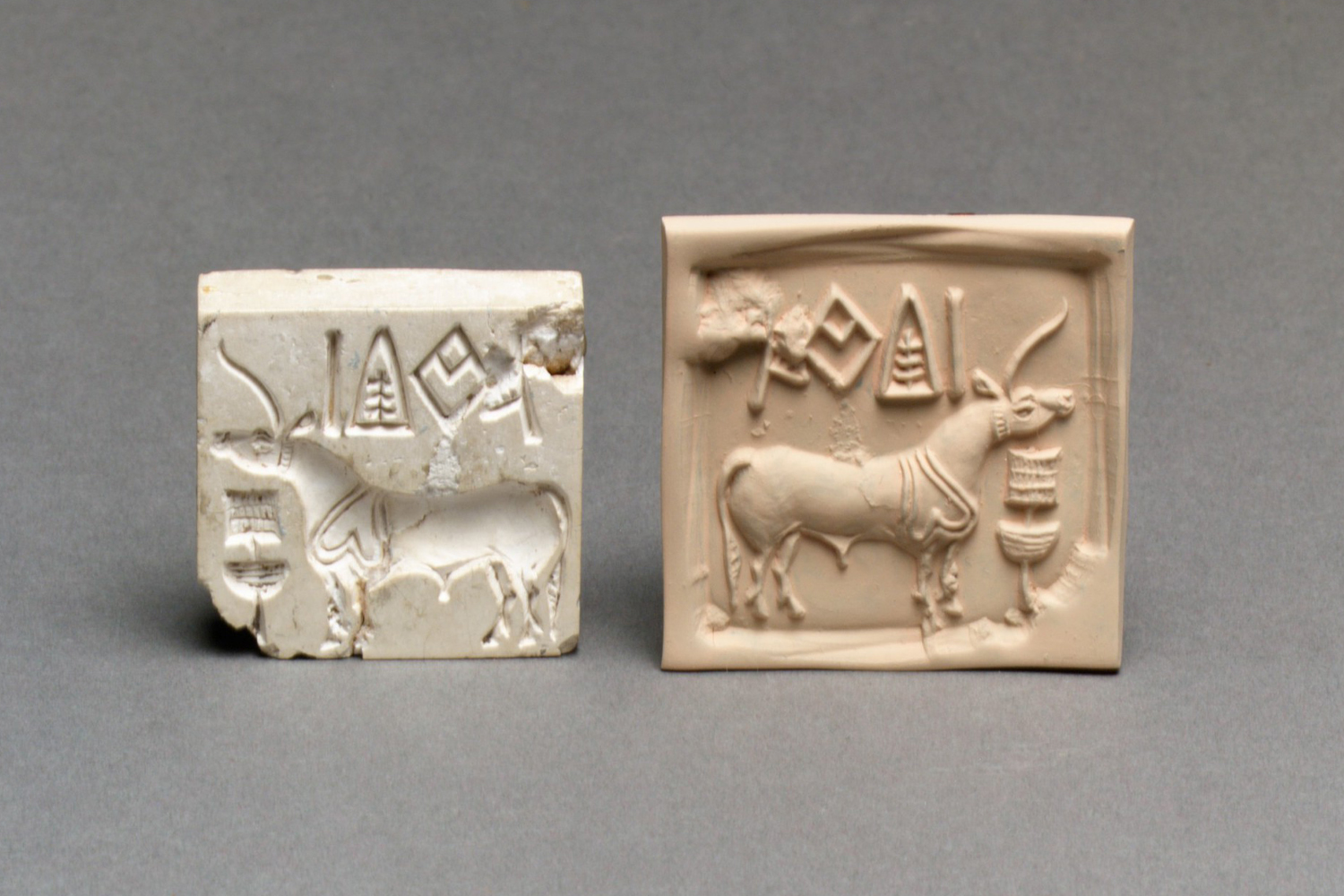
The ruins at Harappa — named for the present-day village located a kilometre away — survive as a cluster of mounds: hillocks built up over centuries by the accumulation of mud-brick debris, collapsed buildings, and wind-blown dust. With erosion or excavation, the faces of the mounds expose successive layers or ‘strata’ of occupation, which is the primary source of useful information about how the city was settled over time. The site first attracted interest in the early nineteenth century; subsequently British archaeologist and Director-General of the Archaeological Survey of India (ASI) Alexander Cunningham published findings of stone tools and pottery recovered from the site during his excavations of the 1850s and 1872. He reported finding a seal with a bull and some writing, which he believed to have originated outside the subcontinent. At the time, he believed the site to be no older than about the mid-first millenium CE.
The real antiquity of the site was only understood in the 1920s, after Indian archaeologist RD Banerji’s discovery of Mohenjo-daro, a site in the Sindh province of present-day Pakistan, that appeared to have hosted a somewhat larger city than Harappa. In 1924, British archaeologist John Marshall noted similarities in the use of copper in the excavated tools, the absence of iron, the inscribed seals, and the symbolic writing system unrelated to Brahmi, to conclude that Harappa and Mohenjo-daro were part of a single, previously unknown civilisation older than any other known in the subcontinent. His findings were corroborated by scholars of Mesopotamia who recognised parallels between these newly excavated sites and the third-millennium BCE cities of Sumer and Susa (in present-day Iraq and Iran, respectively).
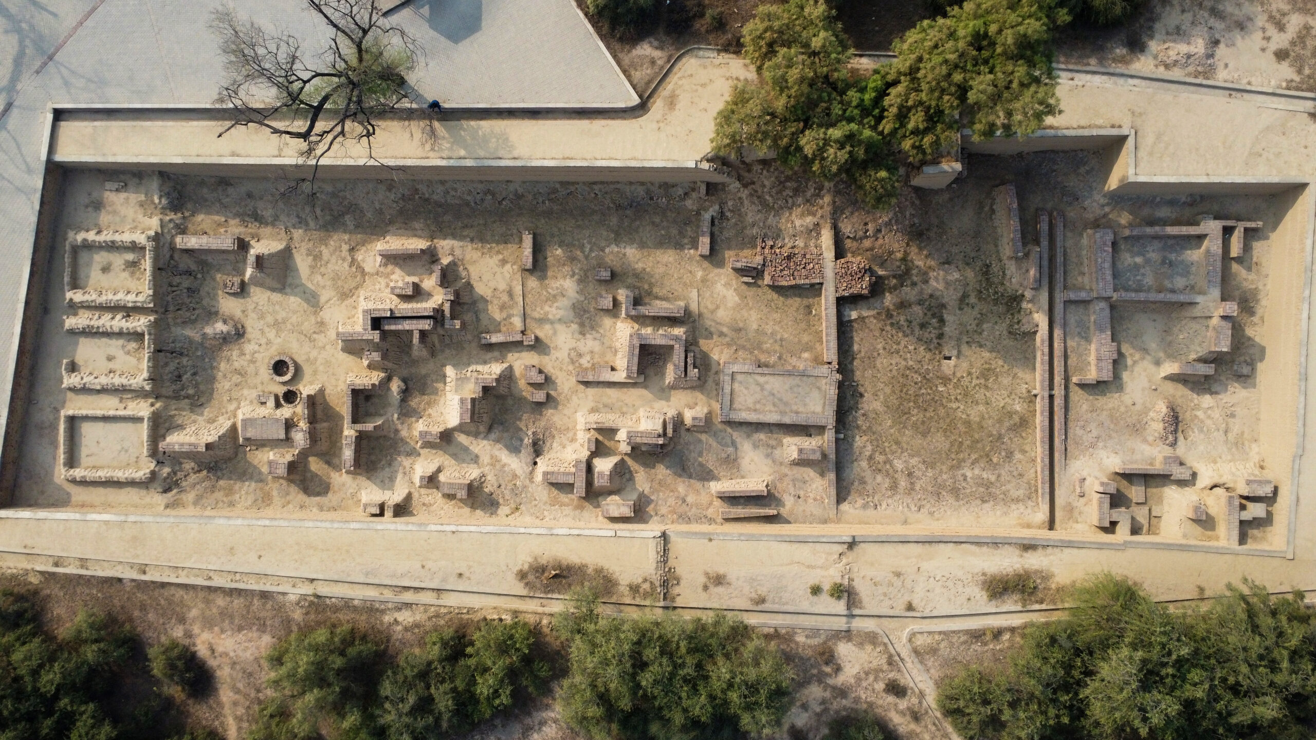
British archaeologist Mortimer Wheeler, appointed Director-General of the ASI in 1944, introduced more rigorous methods of stratigraphic excavation, eventually known as the Wheeler-Kenyon Method, that allowed for a more precise understanding of the site’s occupational context. At Harappa he interpreted the large AB mound as a fortified citadel and excavated the large cemetery labelled R-37, which shed considerable light on Harappans’ burial practices. With the introduction of radiocarbon dating in the 1950s, a more reliable chronology of the Indus civilisation was established. Excavations have continued under the joint Pakistani-American Harappa Archaeological Research Project (HARP), which began in 1986. A combination of new excavated material and more sophisticated dating techniques have helped establish the currently accepted periodisation.
As the first and largest cities of the civilisation to be excavated, Harappa and Mohenjo-daro came to define it; though little is known about whether either city functioned as a capital or about the political relationship between them. The features documented there — a distinctive wheel-made red pottery painted with black motifs, the Indus script (appearing chiefly on seals and as yet undeciphered), bricks of standardised proportions, uniform stone weights, straight streets meeting at right angles served by covered drains, walled elevated sectors set apart from the lower town, masonry wells and tanks, and cemeteries in which the dead were laid out supine in a north–south alignment — became the markers by which sites discovered later across the whole region were identified as IVC settlements. The discovery of this extensive civilisation pushed back the onset of urbanism and writing in the subcontinent by more than a millennium, transforming the existing understanding of South Asian history. In 2004, the archaeological site at Harappa was added to UNESCO’s Tentative List of World Heritage Sites.
Layout
The city stood on the southern bank of the Ravi River, whose course has since shifted several kilometres north. During the Mature Indus period, it consisted of several walled sectors arranged around a central depression that may have served as a reservoir, together with unwalled suburban sectors beyond. Each of the major sectors appears to have been enclosed by its own massive mud-brick wall, entered through brick gateways, though only the walls of Mounds AB and E have been excavated; many of the larger gateways were equipped with projections that have been interpreted as bastions. These walled sectors were established at different times as the city grew, yet the recovery of characteristic painted ceramics, figurines, inscribed seals and ornaments from all the excavated mounds is evidence that there was constant interchange of goods among sectors, and that their inhabitants shared a single culture. In its entirety, the city covered approximately 150 hectares and possibly supported a population of around sixty thousand.
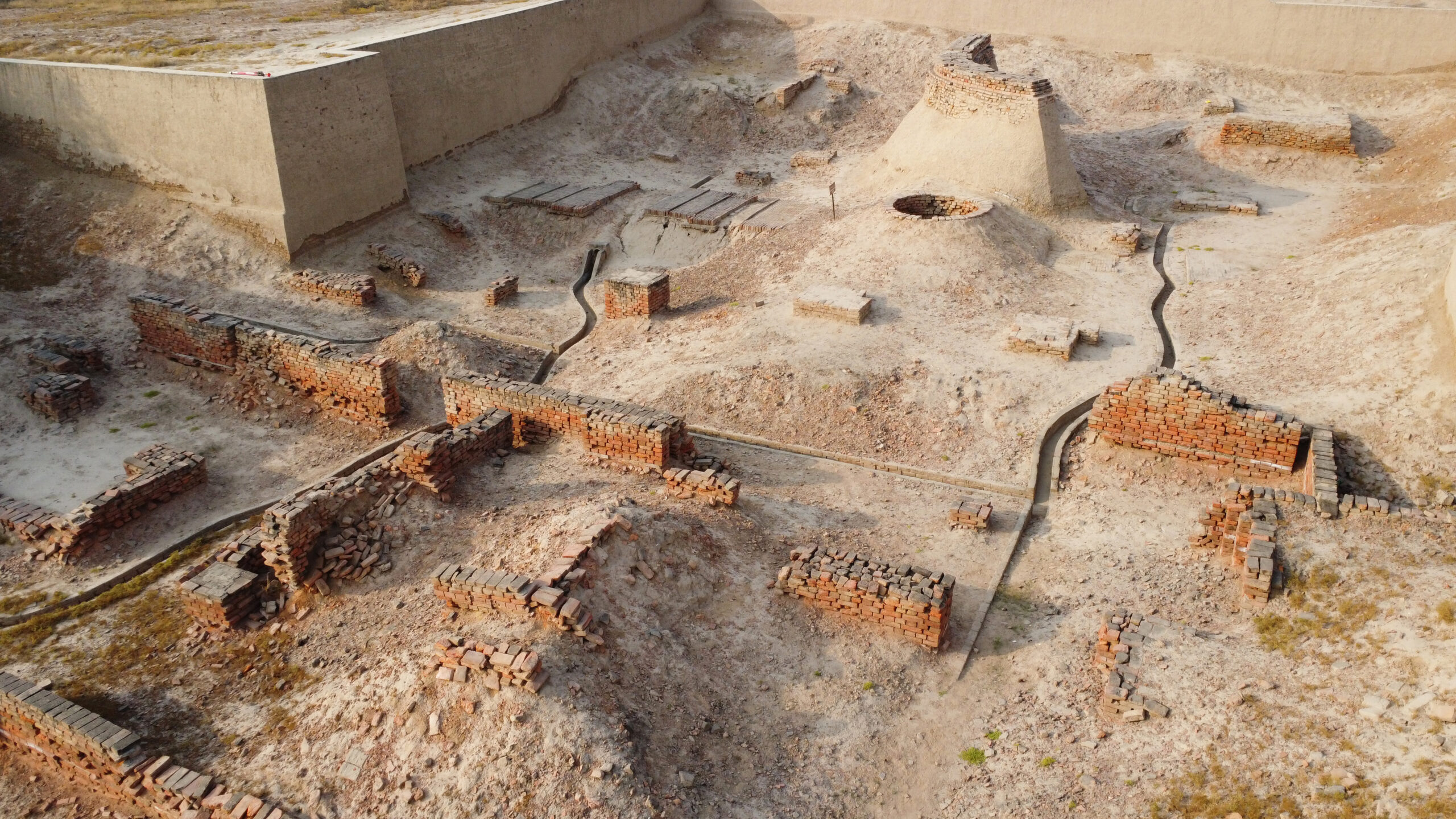
Like other major IVC cities, the one at Harappa was laid out according to a broadly rectilinear plan, with many of its principal streets aligned roughly north–south. Mound AB, the highest mound at Harappa, stands on the western side of the settlement and contains a well, a row of platforms possibly used for bathing, and a large drain to collect the spilled water. Surrounded by a high wall with square ramparts, it forms the elevated sector known as the citadel. Little remains of the walls due to the extensive plunder of bricks in the nineteenth century by contractors building the Lahore-Multan railroad; bricks from the mound were also used to build the large tomb of a medieval Muslim saint named Nur Shah situated atop the north-east wall.
To its south-east, at a lower elevation, lies Mound E, one of Harappa’s oldest mounds, with pottery kilns, workshops for agate, shell and copper goods, and a tall south-facing gateway; its eastward extension, Mound ET, began as a suburb and was later walled. Between the citadel and the old course of the Ravi lies Mound F, enclosing the building known as the granary as well as a group of circular brick platforms and a walled block of small uniform dwellings.
Infrastructure
The city’s walls appear to have had several functions. In some places they acted as retaining structures for the massive mud-brick platforms that raised parts of the settlement above the floodwaters of the Ravi; elsewhere they regulated movement between different sectors of the city and served as visible expressions of civic authority. While their imposing scale has led some scholars to assume they also had a defensive role, others suggest that they were purely symbolic. The high western mound AB was enclosed by a mud-brick wall up to 14 metres wide at the base and faced with baked brick, with three small gateways on its western face and a larger northern gate leading down towards Mound F. This was interpreted by Wheeler as a military structure and labelled as the citadel. Later scholarship has however noted the absence of battle damage on the walls and Harappa’s lack of elaborate defensive structures such as angled gateways, two- or three-wall fortifications, or moats — such as those found at Dholavira — challenging the idea that Mound AB served as a citadel.
The wall openings are instead simple and often small. The southern gateway of Mound E, for example, was only wide enough for a single ox-cart and may have functioned as a checkpoint where goods entering the city could be monitored or taxed. The repeated repair and rebuilding of walls, streets and drains over many centuries suggests significant urban organisation and administrative continuity.
About 30 metres south of the gateway of Mound E, outside the city wall, lies a small mound containing houses, drains and bathing platforms around what was probably a well. This cluster of buildings possibly served as a temporary rest stop or caravanserai, serving travellers and traders. The modern road running along the southern edge of the mound was probably first established by Harappan traders; it has seen continuous use throughout subsequent history, with the mound’s buildings serving as stables for horses employed in postal relays between Lahore and Multan and the central well rebuilt and used for certain periods.
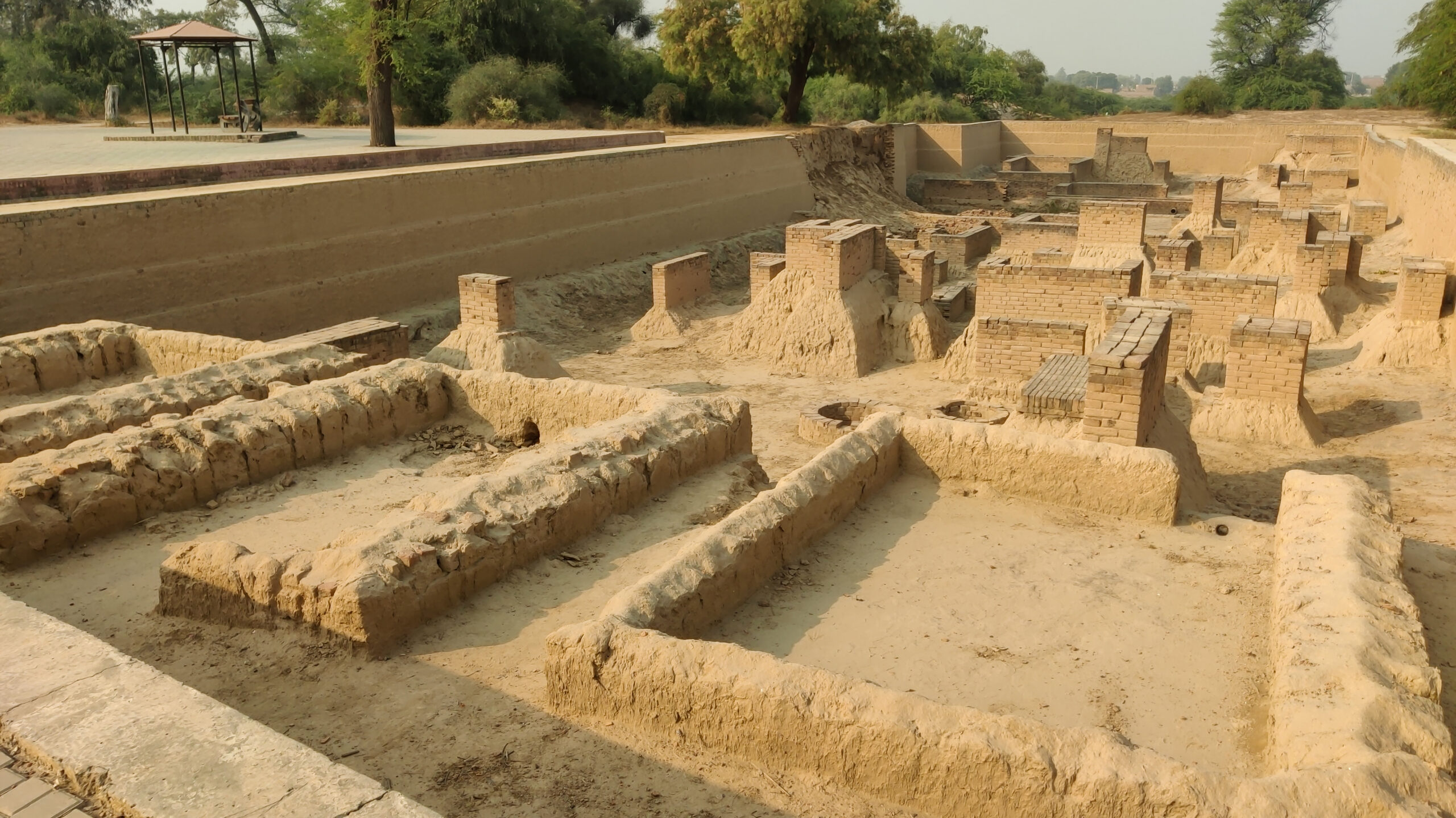
The drainage system of Harappa was notably well-developed. Wastewater from houses flowed out via small brick or terracotta drains into open drains running along lanes and side streets before entering larger covered drains beneath the principal thoroughfares. These were roofed with brick or stone and equipped at periodic intervals with sump pits that allowed solid waste to settle while the water continued onward. The stone or brick covers could likely be lifted for cleaning the drains. Drainage from bathing areas was generally kept separate from sewage. As street levels gradually rose through rebuilding, the drains were also repeatedly raised or reconstructed to maintain their effectiveness. At the main gateway between Mounds E and ET, a sequence of four such drains, built one after another, has been excavated, and some drains appear to have been fitted with wooden sluice gates or grilles, perhaps to prevent unauthorised entry into the walled city.
Unlike Mohenjo-daro, where no formal cemetery has been located, Harappa has yielded two substantial burial grounds, both lying to the south of the city: Cemetery R-37 of the Mature Indus period and, overlying its edge, Cemetery H of the Late Indus Phase. In R-37 the dead were laid extended in pits with the head to the north, sometimes in wooden coffins, accompanied by pottery and wearing ornaments of shell and bead. In Cemetery H, partial remains have been found buried in painted urns.
Whether the city of Harappa was socially stratified remains debated. Some scholars believe the contrast between spacious fired-brick houses and the cramped rows of small dwellings suggests sharp class distinctions, while others note that houses, workshops, markets and public spaces of varying sizes occur throughout the city rather than being concentrated in any single quarter.
Buildings
Harappan houses typically presented blank exterior walls to the street and were entered from side lanes, with rooms arranged around a central courtyard — a design scheme that has persisted in South Asia. They varied considerably in size: the largest had several courtyards with many rooms opening onto them, while more modest houses had a single smaller courtyard and only one or two rooms. Burnt brick was in common use from the earliest periods of occupation, alongside sun-dried mud brick; the bricks were moulded to standardised proportions of 1:2:4 — the usual house brick measuring about 7 × 14 × 28 cm — and generally laid in mud mortar, with gypsum used more selectively.
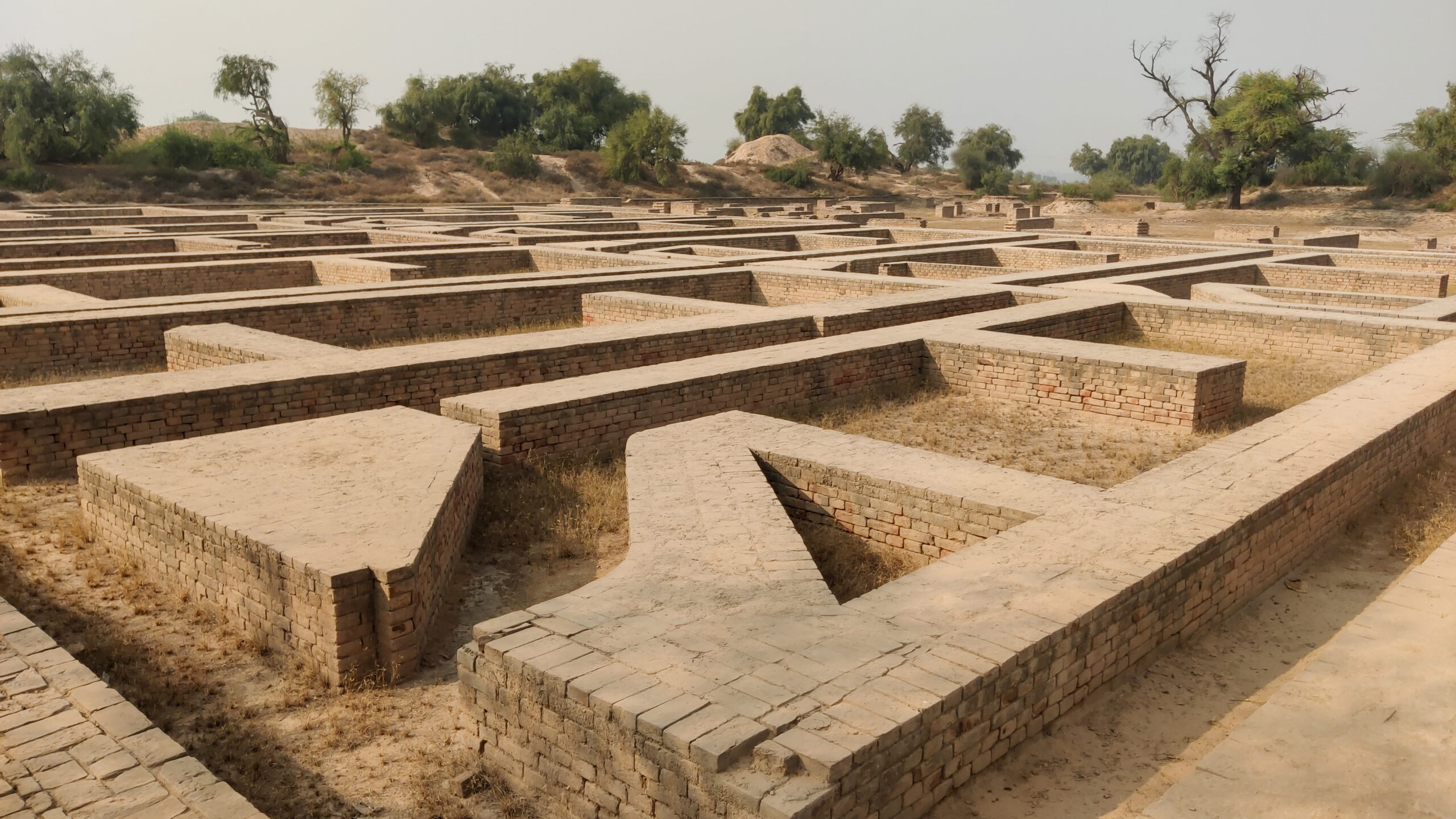
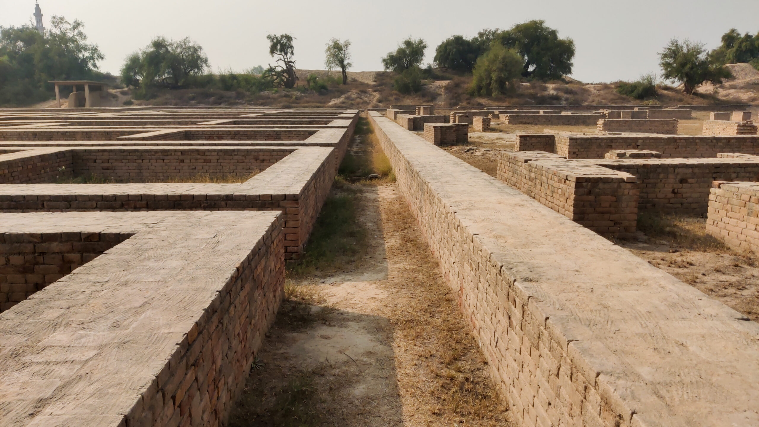
Recent excavations show that most houses contained latrines, with commodes made of big pots sunk into the floor; found alongside were small lipped pots for washing up that resemble those still in use in South Asia. Some latrines were connected to the drainage network, while others featured outlets at the base which allowed waste to seep into the ground. Many houses had baked-brick bathing platforms; some of these served individual houses, while others were communal and served clusters of houses. Despite its size, Harappa appears to have had relatively few wells — roughly thirty, compared with around seven hundred at Mohenjo-daro — suggesting that much of its water was drawn directly from the Ravi and possibly from the central reservoir.
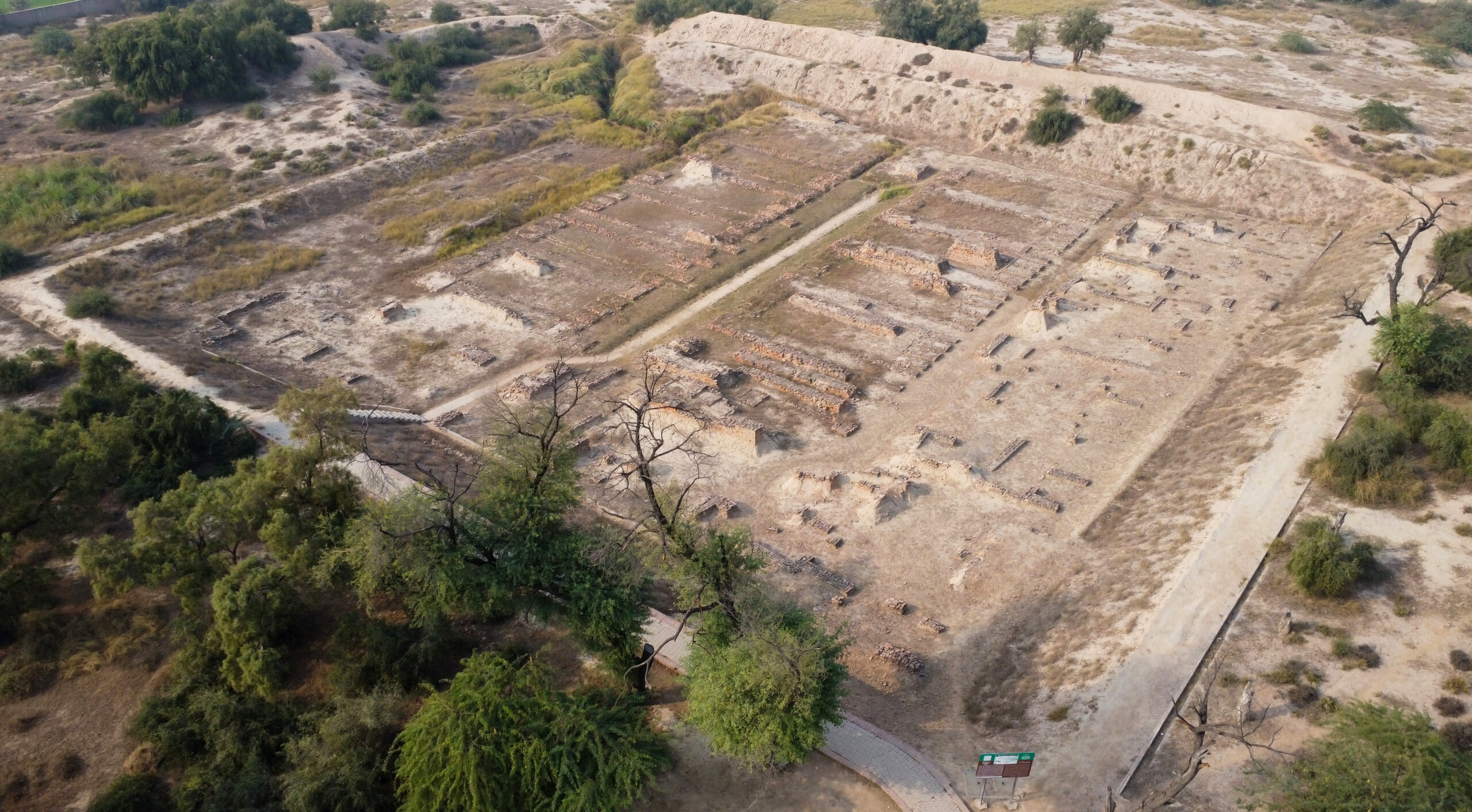
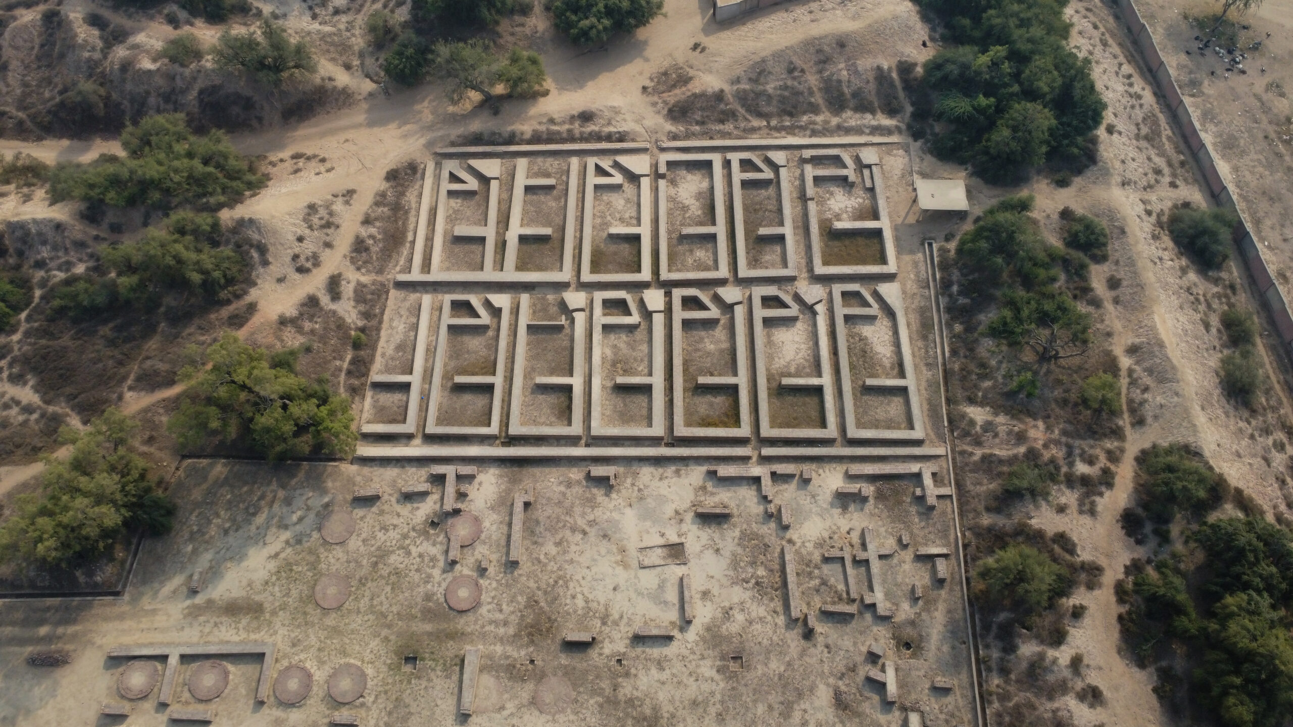
Mound F contains the building interpreted by Wheeler as the ‘great granary’: twelve halls arranged in two rows on either side of a central passage, raised on a massive mud-brick foundation. Its identification as a granary was based largely on comparisons with Roman granaries; however, the building has never yielded evidence of stored grain. Some archaeologists have suggested that it may instead have served as a palace, storehouse, or some other type of public administrative building.
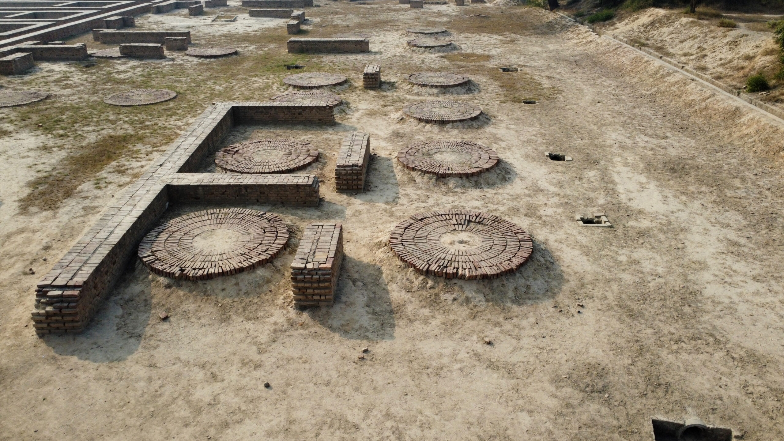
The circular brick platforms nearby are each built with a central hollow that may have held a wooden mortar; husked barley and straw were found there, so these were long interpreted as floors for threshing or husking grain. Re-excavation showed that these platforms stood within individual rooms; now they are generally regarded as industrial working surfaces, with one containing trace evidence of indigo processing. The walled compound of the mound also preserves the substructure of two parallel rows of six near-uniform rooms set on either side of a central passageway. These were once interpreted as quarters for the granary’s labourers, but recent scholarship cites the lack of reliable evidence to attribute a precise purpose to them.
Artefacts
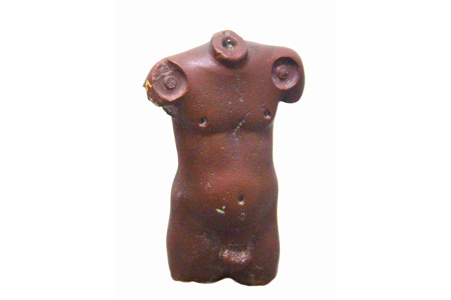
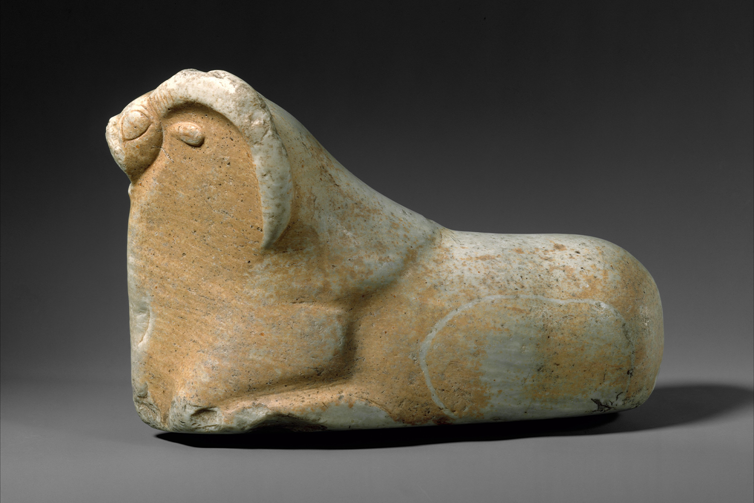
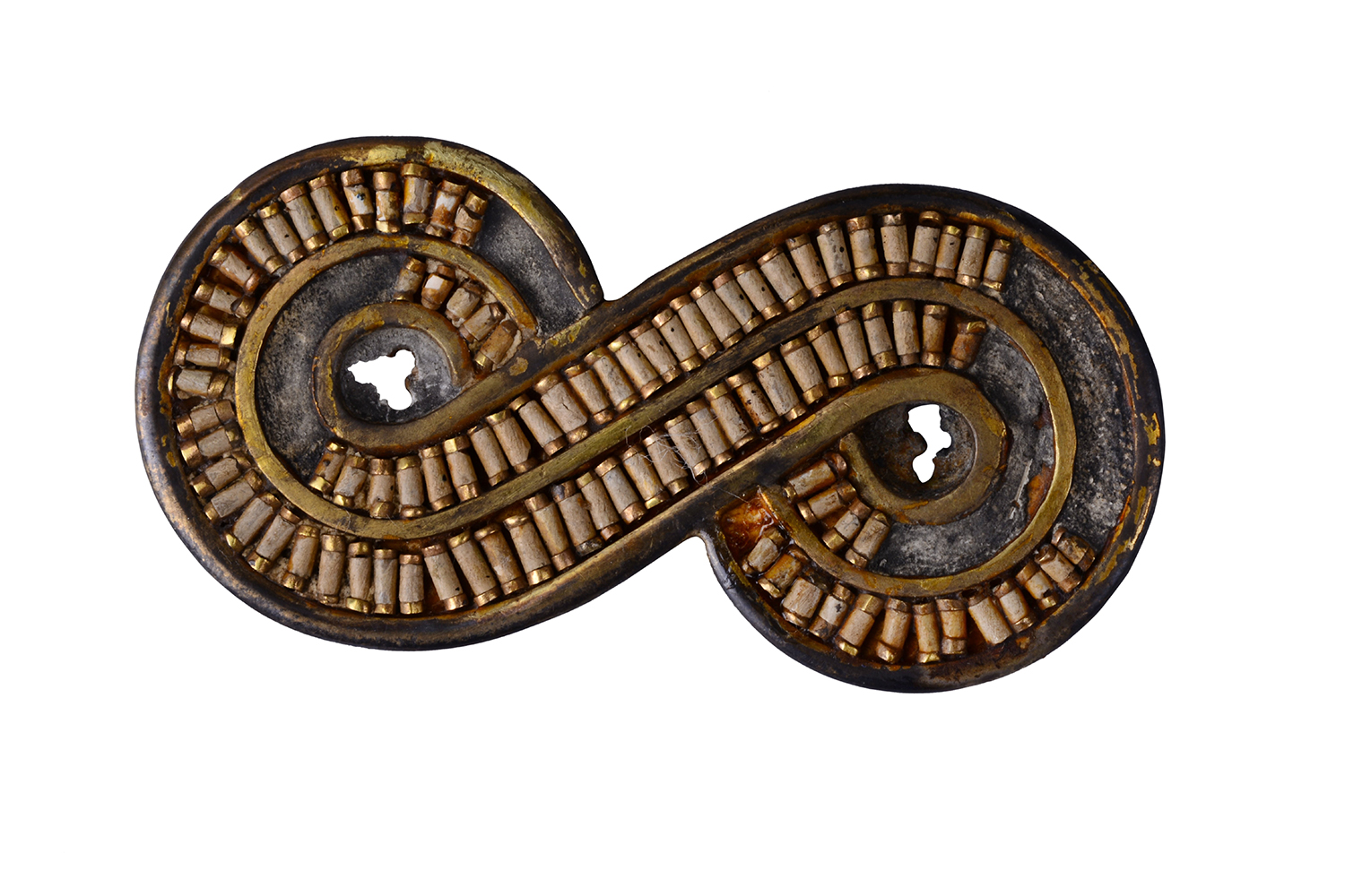
Important artefacts recovered from Harappa include the naturalistic red jasper torso of a man, several votive terracotta figurines of humans and animals, and a number of steatite seals inscribed with the Indus script and symbolic figurative images. The sculptural artefacts reflect both a synthesis of earlier cultural materials from the broader Indus region and the development of styles and techniques unique to the IVC in its Mature phase. With the Indus script still undeciphered, the precise role or significance of these artefacts has been difficult to determine; they nevertheless provide broad insight into the symbolic and material aspects of the civilisation. Several of these artefacts are now part of the collections of the Harappa Museum near the site, and the National Museum in Delhi, India. As with other IVC artefacts, these were divided between the two countries after the Partition of 1947.
First published: 31 August 2026
Image Gallery
Bibliography
Coningham, Robin, and Ruth Young. The Archaeology of South Asia: From the Indus to Asoka, c. 6500 BCE–200 CE. Cambridge: Cambridge University Press, 2015. https://doi.org/10.1017/CBO9781139020633.
Farid, Sana. “Amidst the Ruins in Harappa.” Express Tribune (Karachi), September 4, 2011. https://tribune.com.pk/story/241920/amidst-the-ruins-in-harappa.
Habib, Irfan. The Indus Civilization: Including Other Copper Age Cultures and History of Language Change till c. 1500 BC. A People’s History of India 2. New Delhi: Tulika Books, 2002.
Kenoyer, Jonathan Mark. Ancient Cities of the Indus Valley Civilization. Karachi: Oxford University Press, 1998.
https://archive.org/details/ancientcitiesofi0000keno.
McIntosh, Jane R. The Ancient Indus Valley: New Perspectives. Santa Barbara: ABC-CLIO, 2007.
Singh, Upinder. A History of Ancient and Early Medieval India: From the Stone Age to the 12th Century. New Delhi: Pearson, 2016.
Feedback