-
ChicagoBhasin, Bhavna. "Mapping Malleshwaram: An Urban Neighbourhood’s Layered Vocabulary." Impart Perspectives, April 24, 2026. https://imp-art.org/perspectives/features/mapping-malleshwarams-layered-vocabulary/
-
MLABhasin, Bhavna. "Mapping Malleshwaram: An Urban Neighbourhood’s Layered Vocabulary." Impart Perspectives, Apr. 24, 2026, https://imp-art.org/perspectives/features/mapping-malleshwarams-layered-vocabulary/. Accessed 22 Jun 2026.
-
HarvardBhasin, B. (2026) Mapping Malleshwaram: An Urban Neighbourhood’s Layered Vocabulary, Impart Perspectives. Available at: https://imp-art.org/perspectives/features/mapping-malleshwarams-layered-vocabulary/ (Accessed: 22 June 2026).
Mapping Malleshwaram: An Urban Neighbourhood’s Layered Vocabulary
Malleshwaram's visual and material culture is tied to a shared and intangible heritage of memories and daily routines, shaping how the neighbourhood is organised, inhabited, and valued.
By Bhavna Bhasin
Link copied!
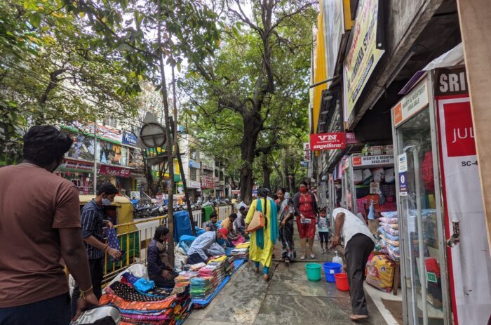
Sampige Road, named after the fragrant champaka (or sampige) trees that once lined it, is a busy commercial hub where traditional shops coexist with modern boutiques. Courtesy GeechuGalu Artists' Collective
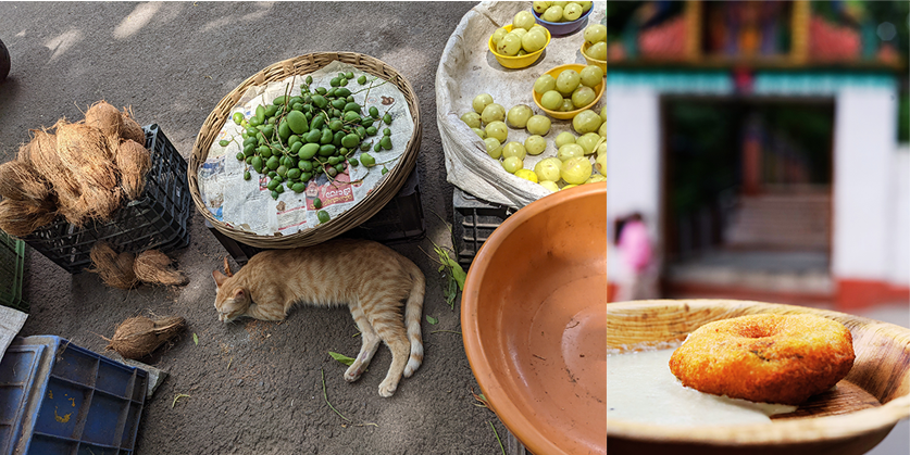
Malleshwaram is often the place one turns to for a slice of Bengaluru’s history. It is where heritage walks often begin, where one goes for a no-frills benne dosa or to indulge in a bit of street shopping on the busy Sampige Road before strolling through the Temple Street flower market that supplies the daily offerings to the Kadu Malleshwara Temple and Nandi Tirtha Temple. Once perched on the city’s north-western, peri-urban periphery, Malleshwaram (also called Malleshwara) was little more than a loose mosaic of grazing commons, wooded patches, and scattered village settlements in the early 1800s. Now, it is one of Bengaluru’s oldest, planned localities.
Emblematic of a slower time, and a site of intense nostalgia, it represents the city’s ‘old world’ charm rooted in Dravidian culture — far removed from its newer identity as a tech hub. Its visual identity has developed slowly, over generations. A site of negotiations, interactions, and planning, it was shaped by colonial urban design, anxieties over epidemics, sanitation and caste purity, networks of patronage around art, education, religion, commerce, and concerns around how the site developed as it moved from the ‘periphery’ of Old Bangalore to the ‘heart’ of modern Bengaluru.
Malleshwaram has long been a site of stratified development, born of the needs of successive generations and eras. Each layer remains, faintly visible, shaping the one that follows. Rather than just a cluster of structures, the site’s material culture is intimately tied to the intangible heritage of memories and shared cultural continuities, of daily routines, rituals, and habits tied to specific neighbourhood spots; it is a space of lived experiences.
A ‘model’ extension
Bengaluru came under the twin administration of the Wadiyars (the Mysore Royal Family) and the British East India Company after Tipu Sultan’s defeat in 1799. Eventually, both these powers would jointly develop Old Bangalore into a modern city.
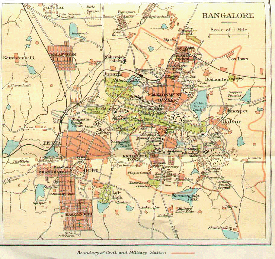
The British-administered Civil and Military Station (CMS) was established in 1806, east of the ‘native’ petta or Old Pete area controlled by the Wadiyars. A strip of land separated these two neighbourhoods. The new ‘white’ settlements, established on higher ground with wide tree-lined roads in a grid layout, had well-ventilated, bungalow-style housing, and better sanitation. The centuries-old petta around the Bangalore Fort, on the other hand, was densely populated with congested, narrow lanes connecting a maze of markets — the city’s central commercial hub.
When the bubonic plague struck in 1898, killing about 10% of the city’s population, the disease burden was felt most acutely in the congested Pete area and the ‘damp’, low-lying Blackpully area (now Shivajinagar), where migrants from marginalised communities, such as the Pariahs, Gollas, and Dhobis, had settled to provide labour to the British settlements. Knoxpet (now Murphy Town), built in the early 1880s for the servant class, was also badly affected because it was topographically below Ulsoor lake, and damp all-year round. The immediate response by colonial authorities was to depopulate the ‘native’ areas through demolition drives and forced removals. It also became apparent that ‘plague-proof’ settlements needed to be built on higher grounds, favouring decongested grid layouts with wide roads, well-ventilated homes, and planned waste and water management.
Several extensions to the petta were being planned by the Wadiyars even before the plague hit — to be built along the lines of British settlements, but for the Indian gentry. The Malleswaram extension, founded in 1889, was one of them. The legend goes that Setlur Venkataranga Iyengar, assistant commissioner of the city’s municipal corporation at the time, discovered the existing 17th-century Kadu Malleshwara Temple (Forest Shiva Temple) on a hillock surrounded by a village settlement and proposed the site for the new ‘modern’ suburb. The plague simply accelerated these plans.
Malleshwaram was envisioned as a settlement for multiple communities. This diversity, however, was not without structure — it came in the form of eight distinct residential clusters, or blocks, segregated by caste and community. Historical records note separate wards for Muslims, native Christians and different Hindu castes, such as the Lingayats, Vaishnavas, Brahmins, and Vaishyas. The central, well-serviced streets housed dominant groups, while the more peripheral clusters housed those with lower occupational and caste status. Malleshwaram thus grew as a multicultural settlement but a spatially ordered one. Its grid carried plurality and segregation at once — a social logic that would later surface in its infrastructure and public life.
A networked neighbourhood
Seen as a ‘retirement’ haven, senior civil servants and government employees bought plots in Malleshwaram as did illustrious educators, writers, artists, and cultural mavens. K Seshadri Iyer, then Dewan of the Mysore Kingdom, took a keen interest in developing Malleshwaram as a “model hygienic settlement” for Indians, as did HV Nanjundaiah, the first Vice-Chancellor of Mysore University. Both eventually became residents of the neighbourhood after they retired. Such influential residents and civic minded retirees with social clout and access to networks of state and royal patronage, in addition to private endowments, have been a critical influence in developing Malleshwaram through landmark cultural, educational, and religious institutions.
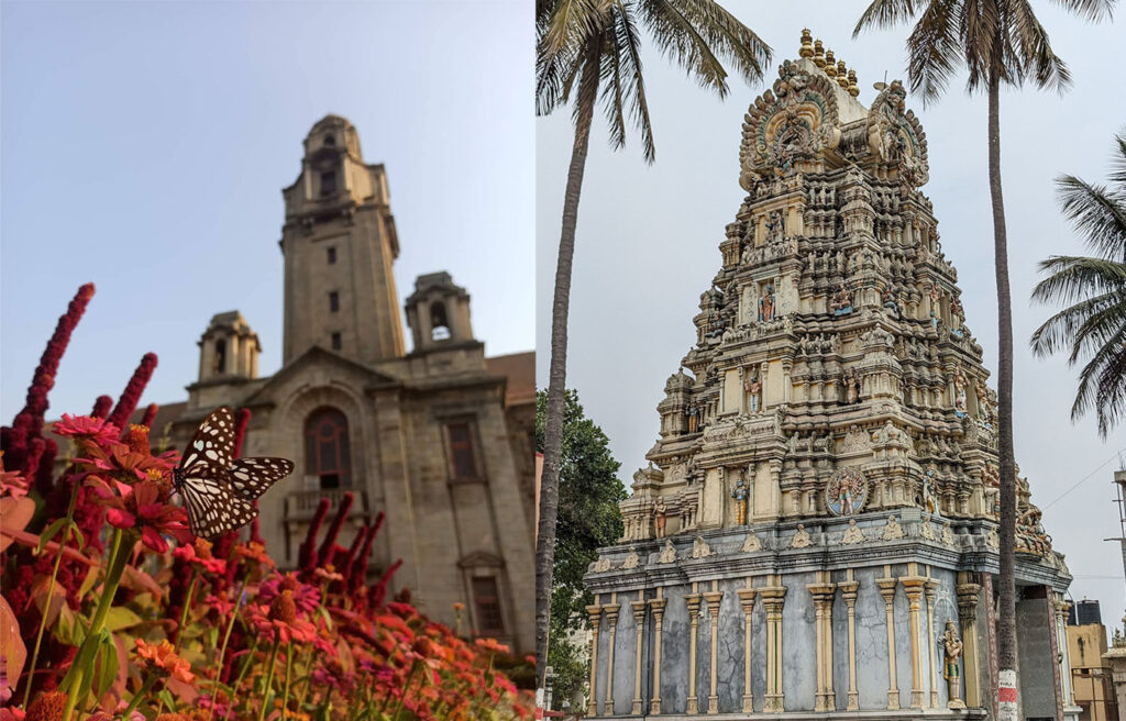
In many ways, besides the obvious colonial era layout, Malleshwaram resembles the traditional South Indian agrahara with spacious row housing centred around a temple hub. Just like those medieval residential housing schemes of yore, Malleshwaram too was designed to be self-contained, with markets and green spaces, and serve as a spiritual and educational hub.
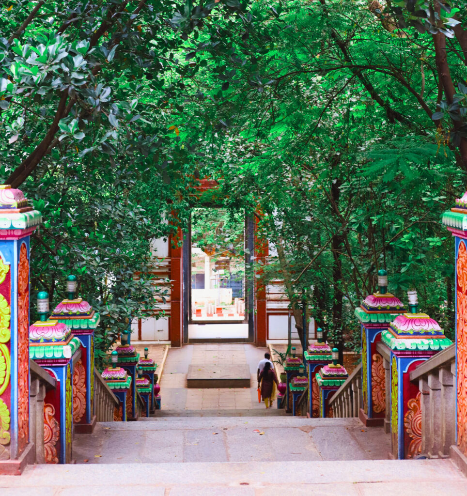
The modest, Dravidian-style Kadu Malleshwara shrine, part of Malleshwaram’s origin story, still plays a vital role in the daily rituals and habits of residents and is an integral part of the neighbourhood’s cultural fabric. From this temple, perched among treetops, a short walk through residential lanes takes you to the Nandi Tirtha temple, a sunken shrine below street level, that residents claim is centuries old. It lay buried till 1997, when while digging for an apartment foundation, workers broke through the ground and found a water-filled stone tank. At the mouth of this tank, they found a south-facing Nandi from whose mouth water continuously flowed, pointing to an ancient water channel from a time when ecology and worship had intertwined.
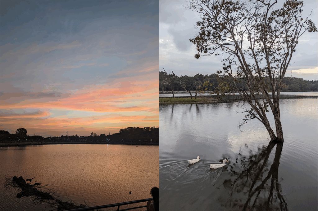
To trace the source of the water flowing from Nandi’s mouth requires a short walk toward the northern edge of Malleshwaram, where the streets open into a clearing next to a lake that stretches across thirty-five acres. Ringed with walkers and migratory birds, Sankey Tank, built in 1882 by Colonel Richard Sankey, owes its existence to an older form of ecological intelligence. Bengaluru’s agrarian communities designed chains of kere (tanks) at natural depressions. Rainwater cascaded from one lake to another through rajakaluves (storm drains). The sloping terrain carried water forward, recharging wells and buffering floods. These lakes functioned as commons. They were ecological, social, and infrastructural, all at once.
With no perennial rivers nearby, the city depended on stored rainwater. Malleshwaram owes its very existence to this tank which is a symbol of the indigenous knowledge system of kere. However, today, very little binds ecology to water infrastructure or divinity. With the channels paved over, the tank now holds water largely within its boundary, causing frequent contamination and flooding. “Cities must be observable to be accountable,” says urban designer Nidhi Bhatnagar. Visibility, in this sense, is traceability. It allows residents to see how trade-offs occur and how governance settles into streets, boundaries, and infrastructure. It helps to link present-day concerns like traffic congestion, water scarcity, and encroachments to layered historical and spatial processes embedded in the neighbourhood.
A slow evolution
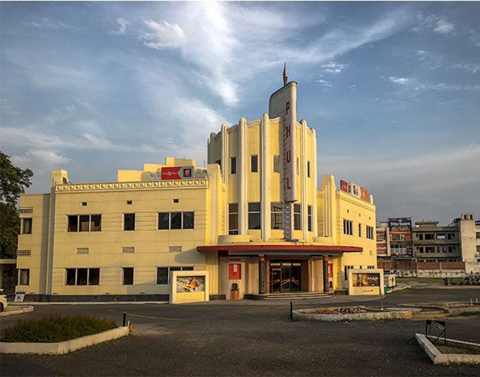
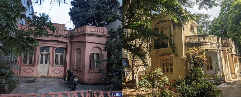
Malleshwaram’s streetscape, even as late as the 1980s, consisted of mostly single-storeyed houses with deep verandahs, inner courtyards, and gardens that allowed light and ventilation. The neighborhood also saw the Art Deco style sweep in through building features like curved edges, intricate grills, and tropical pastel hues, like blue, yellow, and pink — a visible transition from traditional aesthetics to modern 20th-century design. Architect Suchitra Deep, who has mapped these structures, notes that there were once close to a hundred Art Deco homes in Malleshwaram, of which about sixty have been documented. Not every house carries all the elements, she says, but “when you observe a selection of them, you begin to notice common features.” The style in India, she explains, evolved into a “tropical Art Deco,” where global geometric forms were absorbed into regional styles. Walking through Malleshwaram today, these buildings feel less like monuments to modernity and more like ongoing conversations with fragments from a time when new materials and aspirations were folded gently into the neighbourhood’s existing rhythms.
Markets, homes, and livelihoods grew together in this self-contained enclave. Trade-oriented communities, from weavers to spice traders, found their way here. South Indian eateries and family-run stores would become cherished and iconic neighbourhood haunts. Last-mile transportation services, from buses and rickshaws to single-horse-driven carts, called jhatkas, would ferry people within Malleshwaram.
With Bangalore’s ascent as an IT hub, heightened demand for housing and ancillary services slowly but surely sculpted Malleshwaram’s streetscape yet again. By the 2000s, Malleshwaram, while maintaining its distinct cultural ethos, had a changed skyline with redeveloped apartment blocks and multi-storey housing coming up next to heritage homes.
If you want fossils from an older Malleshwaram, head to the Central Tiffin Room, or stroll along the 8th Cross Market. Here commerce still unfolds at a human scale. Vendors and flower sellers spill their wares onto the pavements, echoing the older trading culture of the Pete where markets were embedded in everyday life. Yet a short distance away, Mantri Mall stands on the site of the old Raja Mills, marking a shift toward enclosed retail and global consumption patterns.
Subversive art in caste-coded spaces
But, despite the changes, over decades, the original Malleshwaram layout is still visible. Driven by anxieties around sanitation and epidemics, segregation was a priority for early residents. The grid layout with wide roads, which once separated residential clusters, has in recent times earned Malleshwaram the chance to become the classic ‘15-minute’ walkable neighbourhood.
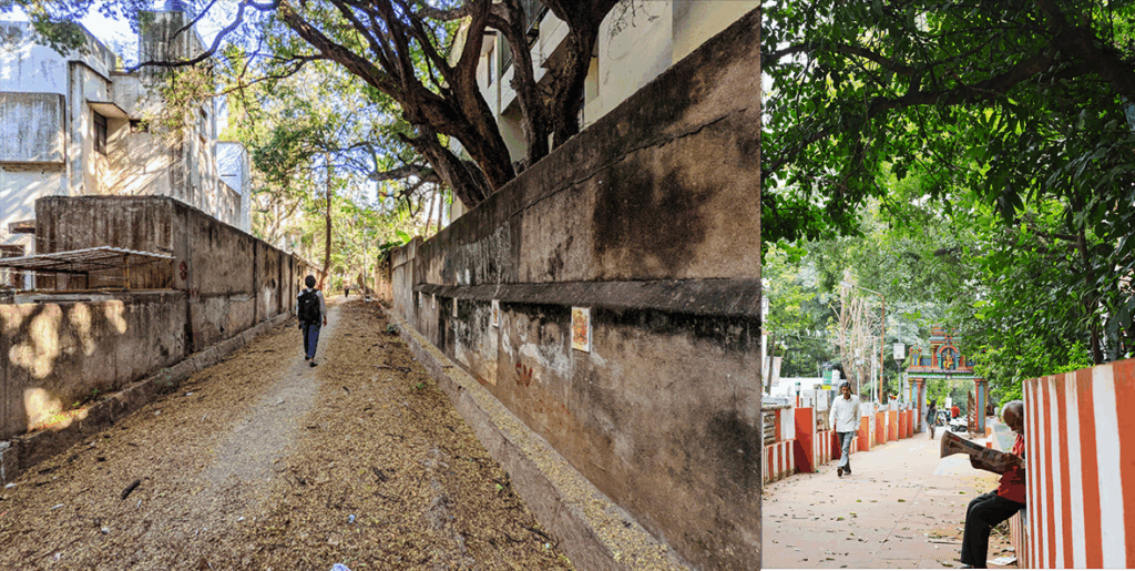
Perpendicular to these main residential roads, are the conservancy lanes that were designed to facilitate sanitation work. Manual scavengers would use these lanes to approach the rear entrances of homes to collect night soil, out of sight, reinforcing caste-coded separation. Even after underground drainage was introduced in 1922, which eliminated the need for manual scavenging, the lanes stayed peripheral. They were marked by a social memory that discouraged their use in the largely upper-caste neighbourhood. Falling into disuse, they became dark and forbidding alleys prone to garbage dumping, encroachments, and use as public urinals and illegal storage and parking.
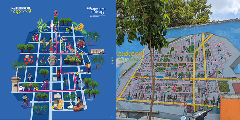
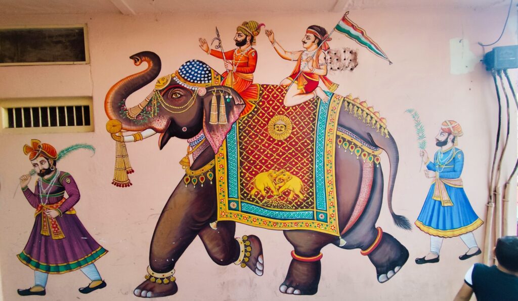
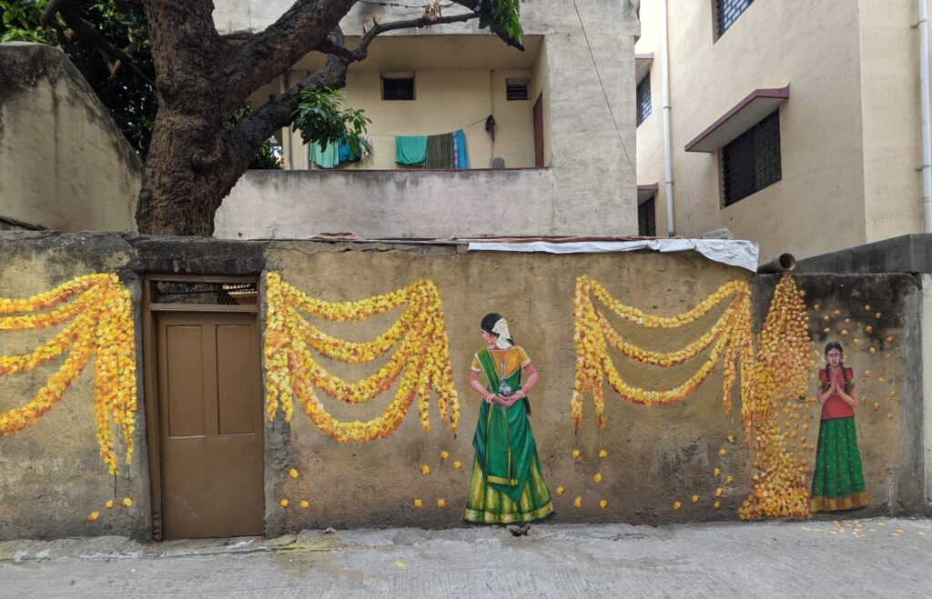
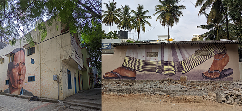
In 2021, the GeechuGalu Artists’ Collective, alongside partners like Purpose, Sensing Local, and Malleswaram Social, co-conceived the Malleshwaram Hogona [Let’s go to Malleshwaram!] initiative to make the neighbourhood more pedestrian-friendly. The neglected conservancy lanes were transformed using wall murals and were subsequently cleaned, paved, and had streetlights installed. They became a ‘visible’ part of the neighbourhood as an “art walk” route. GeechuGalu’s core member, Yash Bhandari, says, “painting here was a way to catalyse civic action. If art appears only where people already gather, it consolidates attention and affirms hierarchy. If it enters spaces coded as unclean or unsafe, it shifts perception at its source and prompts action.”
The murals emerged from the neighbourhood’s own vocabulary. The face of a pourakarmika (sanitation worker), rendered at eye level rather than in the margins. Saree-clad feet in stride, representing the early morning workers sweeping the streets. In a lane originally designed to keep certain forms of work invisible, art became a way of renegotiating presence. It showed that if a site is attended to, habitual patterns can change. Walkability begins to mean more than the width of a footpath; it comes to include perception, recognition and the right to linger. What was meant to be peripheral, gradually, begins to enter the visible sphere of the neighbourhood.
Negotiating modernity through memory
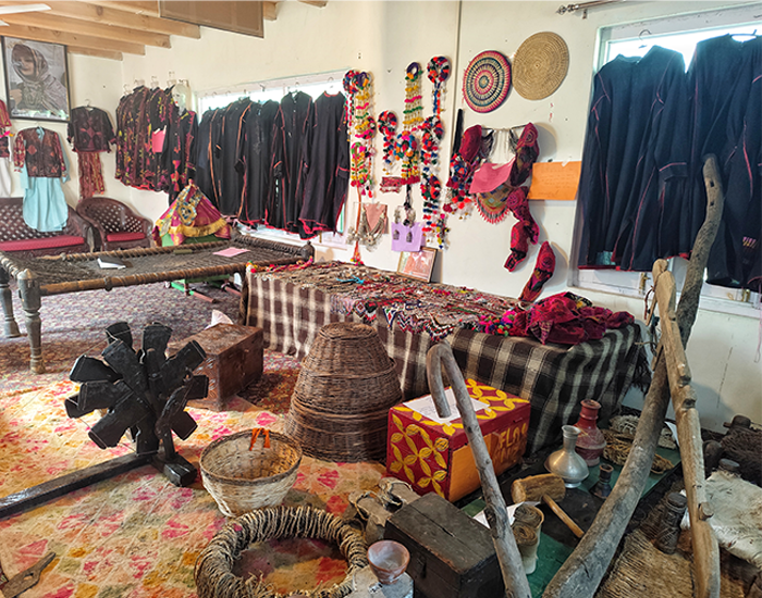
Archiving memories can change how a neighbourhood remembers itself. Malleshwaram Social, initiated by Malleshwaram resident and architect Suchitra Deep, gathers oral histories, photographs and everyday narratives through community meetings and a growing digital platform.
For Deep, archiving reconnects individual memory with collective space, making the neighbourhood feel less like backdrop and more like inheritance. The archive takes many forms. A conversation between seniors recalling how Sampige Road once felt at dusk. A scanned photograph of a demolished home. A map marking trees that no longer stand. Archiving stretches memory across generations and places it in the public domain.
An archive cannot halt commercialisation or reverse demolition. But it can cultivate awareness. When everyday histories are gathered and circulated, belonging becomes tangible. Responsibility becomes personal. To fall in love with a neighbourhood, in Deep’s words, is not sentimentality. It is a way of responding to a version of modernity that arrives without consultation, and of insisting that change be read before it is written over.
Seeing a neighborhood
Neighbourhoods are neither given nor uniform in their logic. They are assembled, revised, and lived into. To see Malleshwaram as a living archaeological site is to recognise that its present is composed of accumulated decisions, each layer leaving an imprint on how space is organised, inhabited, and valued. In this sense, heritage is not what we inherit, but what we choose to keep alive. Traces are not incidental. They are the most immediate record of what we, as neighbours, make together. And in learning to see them, we begin to take responsibility for the layers we add.
First published: April 24, 2026